Parterre with Surrounding Blocks in the Hammarby Waterfront Residential Area
Hammarby Sjöstad, a short background.
Planning Hammarby Sjöstad started around 1990 but ideas about developing the area were discussed since long before. From the very beginning architect Jan Inge-Hagström at the City Planning Administration was engaged in the planning work.
Hammarby Sjöstad was developed as one of the first big-scale examples in Stockholm of the idea of reusing already developed land. A former harbour and industrial area at the inner city fringe was transformed into a new part of the city, characterised by mixed-use development and an ambition to establish good urban design qualities and high standards regarding architectural design.
Parallel to and inspired by the work with Hammarby Sjöstad a re-orientation of Stockholm planning strategies was made as a part of the new City Plan. Urban sprawl should be avoided by building the city inwards and reusing already developed land and developing denser mixed-use urban areas in central locations like, for instance, Hammarby Sjöstad. This marks a break with the suburban development strategy that was typical for Stockholm during almost the entire 20th century, and a re-establishment of urban values in the development of Stockholm.
Hammarby Sjöstad was created in a complicated process with many individuals, authorities and companies involved. The land is owned by the city and leased on long-term basis to a number of developers. All formal plans are the responsibility of the City Planning Administration, according to Swedish planning legislation. But the developers and their architects have been involved in the process from the beginning. The planning and developing process can be characterized as a dialogue-driven activity between the city and the developers.
Ambitious goals were also set up from the beginning to using advanced environmental technology that meets up to high standards.
Hammarby Sjöstad is located close to the border to the city of Nacka, which also has development plans for the near area. The development of Hammarby Sjöstad requires heavy investments in public transport and roads. A common master plan programme for the area was made in 1995 in co-operation between the two cities Stockholm and Nacka, the County Council and the National Road Authority. This programme has ever since been the fundament for the development of Hammarby Sjöstad.
In 1996 a number of architects were engaged to make parallel sketches for the development. Their proposals were compiled together with work by the City Planning Administration and the result was used as the basis for a more detailed and deepened planning programme for Hammarby Sjöstad. This programme, a living document changing as the work with Hammarby Sjöstad is proceeding, serves in its turn as a base for further detailed planning.
Surrounding Hammarby Sjö, a bay in the inner part of the Stockholm Archipelago, Hammarby Sjöstad is divided in several areas. The development started in northern part, located on Södermalm, which is one of the big inner city islands. The southern part is the bigger one, and the first developed area here was Sickla Udde and then Sickla Kaj and Sickla Kanal. Further development is now actual in Hammarby Gård, Lugnet and Henriksdalshamnen. All together the area will have around 10 000 dwellings and lots of work space, forming one of the greatest urban areas in Stockholm.
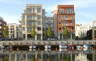
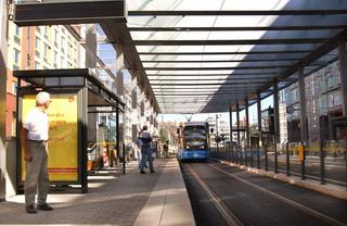
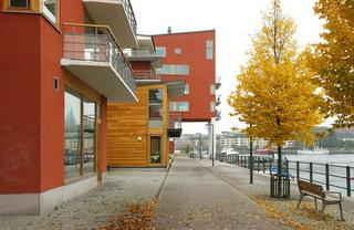
A central urban design motive characterising the area is Hammarby Allé, a broad avenue whith trees rows and a tramline in the middle through the area. This avenue is surrounded by blocks with housing, offices, shops and restaurants. The typical Hammarby Sjöstad block is closed to the street in a traditional urban manner but opens up to the water and the park following modernist ideas, combining the best from two worlds.
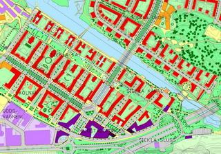
Sickla Kaj and Sickla Kanal, the Blocks forming Sjöstadsparterren
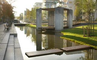
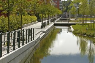
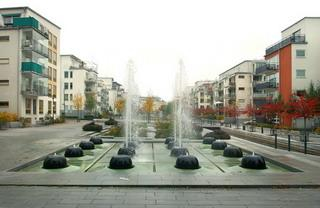
Sjöstadsparterren is a central park through the two block areas Sickla Kaj and Sickla Kanal. Together they form a significant local urban landscape within Hammarby Sjöstad.
The central blocks around Sjöstadsparterren are surrounded by the park Lumaparken, the water area Sickla Kanal, and the streets Hammarby Fabriksväg/Södra Länken and Hammarby Allé. They consist by two detailed plans Sickla Kaj and Sickla Kanal. The detailed planning for this area took place during the years 1997-2001 by the City Planning Administration with Jan Inge-Hagström as the responsible planning architect.
As a link between the plan and the building permissions a quality programme for the urban design was made under the supervision of Jan Inge-Hagström. In this work also the developers architects took place as well as the responsible building permission architects Aivo Rander and Per-Anders Nilsson.
The Sjöstadsparterren is an urban park within the two detailed planning areas Sickla Kaj and Sickla Kanal. The design and functions of the the park were described in program documents by Landskapslaget landscape architects and in construction documents by Håkan Kjerrstadius at FFNS Landskap landscape architetects.
Sickla Kaj
The programme and the concept for the detailed planning of the area comprising Sickla Kaj, the area northwest of Lugnets Allé, was inspired from earlier studies by architect Peter Erseus. Jan Inge-Hagström was responsible for the detailed planning and Stellan Fryxell, at Tengboms architects, was engaged as planning consultant.
The urban design quality programme was made by the City Planning Administration in co-operation with the developers and their architects, and other concerned authorities. The programme was compiled by Jan Inge-Hagström and Stellan Fryxell. The Stockholm Art Council had the responsibility for the artistic objects and decorative elements in the public space.
Sickla Kanal
The detailed plan for Sickla Kanal compises the area southeast of Lugnets Allé. As a part of the initial planning work for this area was parallel architect commissions carried out. As a base for these commissions served a preliminary plan by Jan Inge-Hagström. The result from the parallel commissions was that a proposal from FFNS architects (Per Wigow) was judged to having the greatest qualities and was because of that chosen to be the starting-point for the following planning work.
The work with the further planning was lead by Jan Inge-Hagström who also drew up the detailed plan.
The urban design quality programme was made by Jan Inge-Hagström in co-operation with the developers and their architects, and other concerned authorities. The Stockholm Art Council had the responsibility for the artistic objects and decorative elements in the public space.
Stockholm 21 December 2006
Per Kallstenius Mats Pemer
City Architect Director Urban Planning

