Archeological Sites of Paphos
The project for the integration of the ‘Archeological sites of Paphos’ aims to establish the framework through which current and future interventions within the city of Kato Paphos will commonly aim to reconnect most of the Archeological areas scattered around the contemporary city and create a more coherent image of the place and the history behind it.

 © Marios Christodoulides
 © Marios Christodoulides


The various Archeological sites of Kato Paphos, even though today appear as distinct areas, were once considered part of the historical city of ‘Nea Paphos’. The project attempts to resurrect that understanding by proposing a masterplan for the entire area, which includes several immediate and tangible Architectural interventions as part of this Project. The intent is to ignite the process of bringing these seemingly distinct areas together.
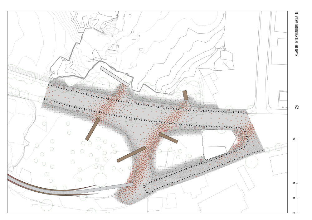
The area under study, an UNESCO World Heritage site, extents from Fabrica Hill where there are numerous important Archeological monuments including a Roman Theater from the 3rd century BC, crosses Apostolou Pavlou Avenue which runs North to South and is the main road that connects Paphos to the seacoast and Kato Paphos, and extents to the West including the area of important Mosaics from the 2nd to the 5th century AD.
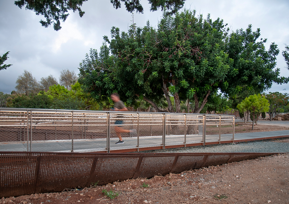
A system of walkways is created to bridge the gap between the Archeological sites East and West of Apostolou Pavlou Avenue. A major part of these walkways is a 380 meters long pedestrian bridge that transcribes the circular footprint of Fabrica Hill before its partial removal to allow for the construction of Apostolou Pavlou Avenue. The bridge signifies the connection between the two major Archeological sites East and West of the main Avenue and transports visitors to the highest peaks of Fabrica Hill offering panoramic views of the entire Archeological site and to the seacoast.
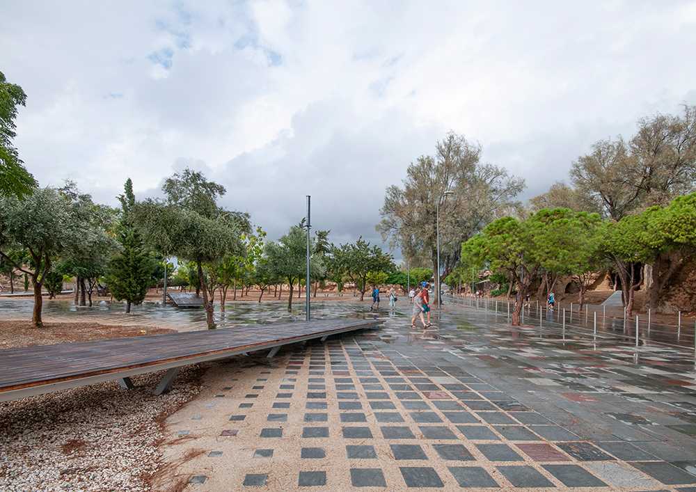
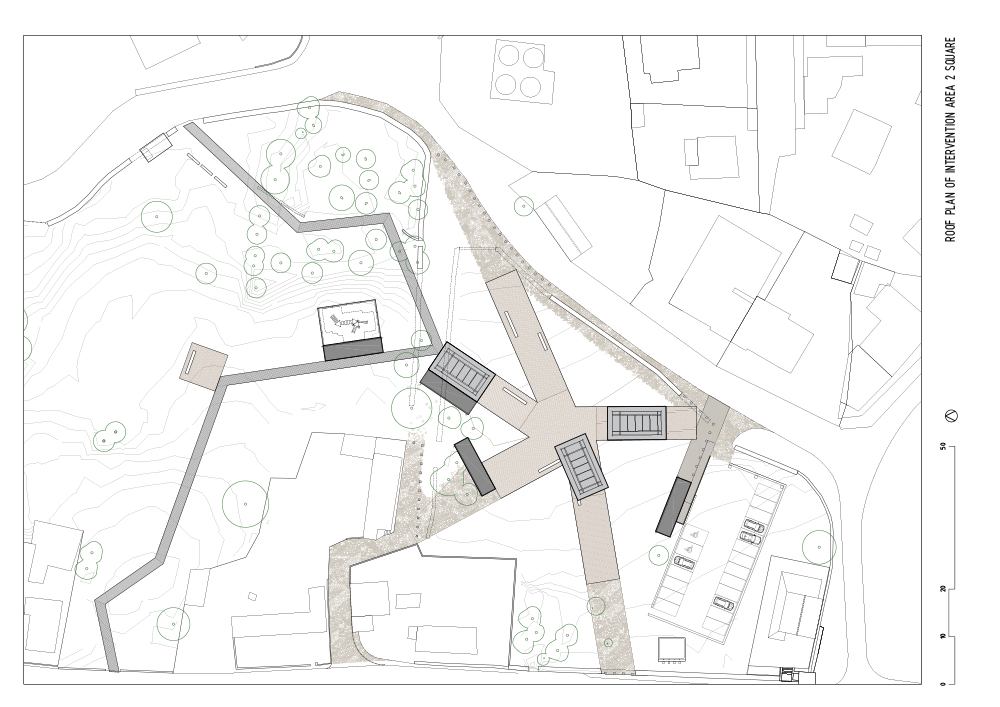
Another objective is to regenerate the neglected areas East of Apostolou Pavlou Avenue which, even though are located within historically important monuments, lack proper urban infrastructure and were never easily accessible from the main roadways surrounding them. A public square is created along one of the major walkways proposed that runs through this area also referred to as the fishing village. Informal pathways crossing the designated but barren plot, are mapped out and transformed into tangible Architecture with their juncture becoming the central meeting point of the square.
A flexible structural system is developed for the bridge with slanted round metal columns supporting a continuous round metal beam. These columns are positioned with a certain flexibility responding to the Archeological findings on the ground. Perforated metal grading is installed as a walking surface on the bridge that allows for plants to grow from the soil underneath, literally connecting the flora of two Natura 2000 areas on either side of the Avenue. The same perforated metal grading is also used on other walkways of the project minimizing the impact in such an important Archeological site.
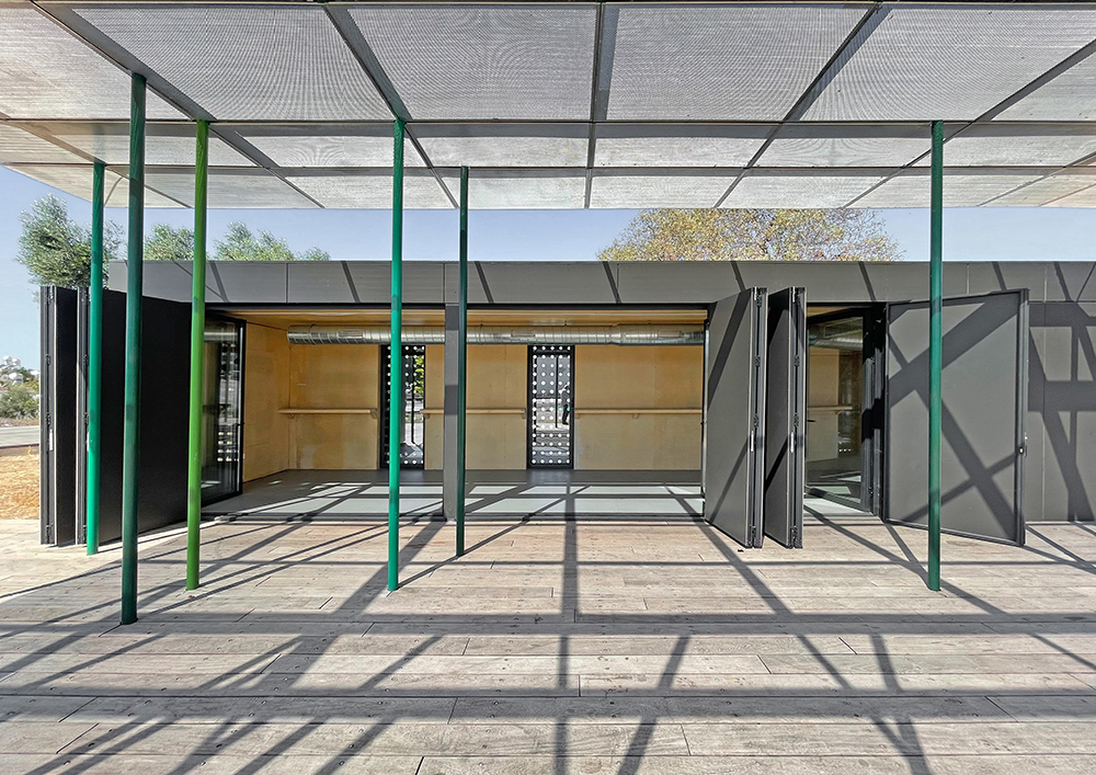
To avoid extensive foundations at the square in the fishing village, the floors are constructed mostly from wooden slats supported on long metal beams with only a perimeter foundation. The various functions within the square are housed in metal frame boxes with also minimal foundations.
The three canopies in the square, made from perforated stainless-steel panels, are supported on a greater number of smaller columns instead of bigger ones requiring bigger foundations. Where streets are replaced with walkways the asphalt is removed and replaced with resilient granite stones.